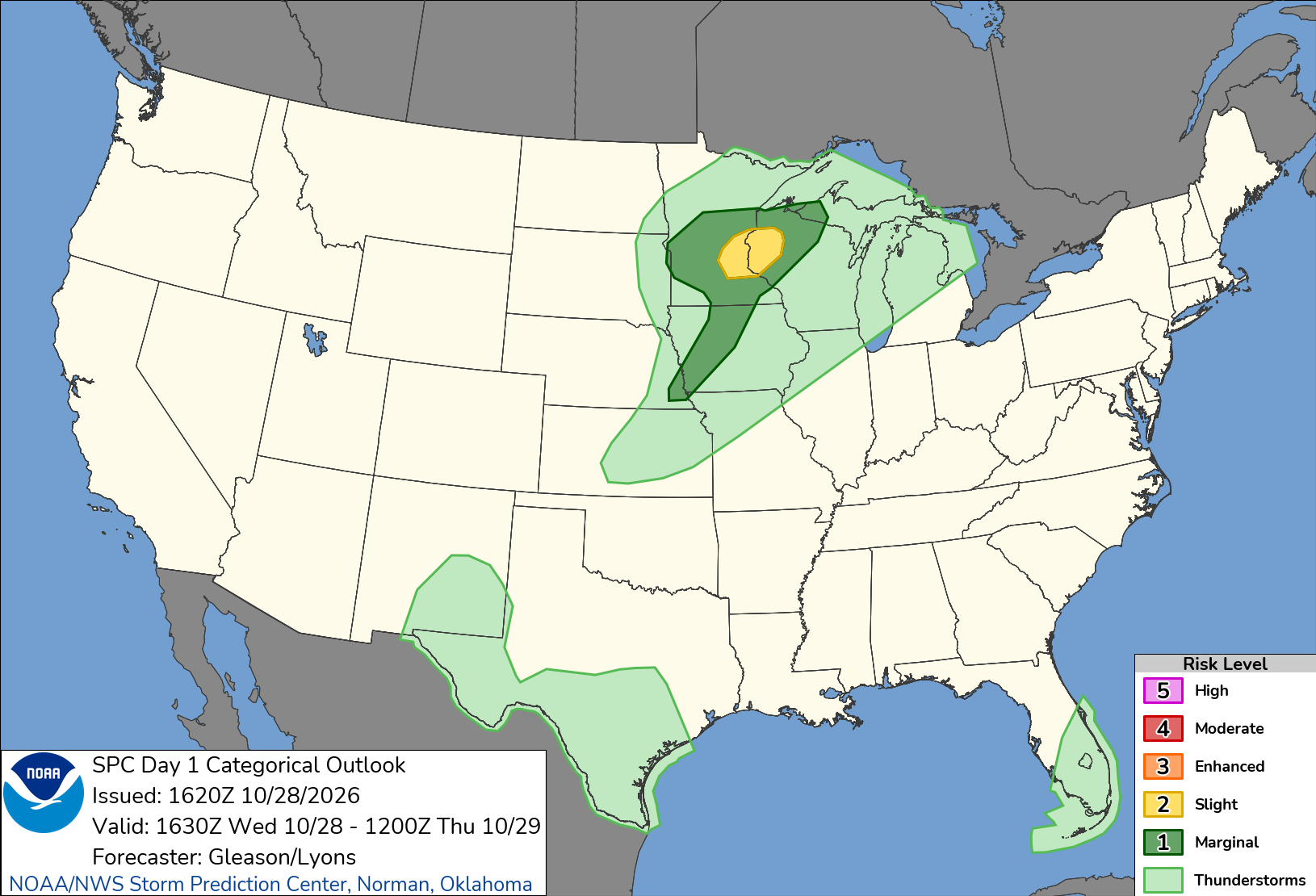
The Twin Cities metro faces a late-October tornado threat Wednesday, Oct. 28, with severe thunderstorms possible in the Minnetonka area during the afternoon and evening.
NOAA's Storm Prediction Center placed portions of east-central Minnesota and western Wisconsin under a Slight Risk, Level 2 of 5, for severe thunderstorms. A few tornadoes, isolated large hail and damaging winds are possible.
The risk remains conditional. Forecasters said wind conditions could support rotating thunderstorms, but limited atmospheric instability could prevent the strongest storms from developing.
The National Weather Service office in Chanhassen issued a hazardous weather outlook Wednesday morning warning of strong to severe thunderstorms across central and southern Minnesota and western Wisconsin.
Forecasters said storms could produce tornadoes, large hail and damaging winds. The office also indicated that trained weather spotters might be needed during the afternoon and evening.
The timing matters for Minnetonka residents. An NWS aviation forecast discussion placed the main line of storms near Minneapolis-St. Paul International Airport between approximately 4 and 7 p.m.
Storms could bring heavy downpours, frequent lightning, gusty winds and hail. The precise timing and severity will depend on how thunderstorms develop.
The forecast calls for an unusually warm late-October afternoon. Temperatures in the Twin Cities could approach 70 degrees, with showers and thunderstorms likely.
Forecasters said cloud cover could limit daytime warming and reduce the severe weather threat. If enough sunshine develops, storms may have a better chance of becoming severe.
The risk of a tornado does not mean one will occur. Residents should monitor updated forecasts and be prepared to respond quickly if the National Weather Service issues a warning.
What to do if a tornado warning is issued
The National Weather Service advises residents to move to a basement, designated storm shelter or small interior room on the lowest floor of a sturdy building.
Stay away from windows. At work or school, follow tornado shelter procedures and avoid large open areas such as gymnasiums and cafeterias.
People in mobile homes, sheds or other lightly constructed buildings should seek shelter in a sturdier structure. Anyone outdoors should move to a substantial building as quickly as possible.
Residents should have multiple ways to receive severe weather alerts, including Wireless Emergency Alerts on mobile phones and NOAA Weather Radio.
The latest local forecasts and active warnings are available from the National Weather Service Twin Cities office.
Severe weather conditions can change quickly, particularly when storms begin developing.